
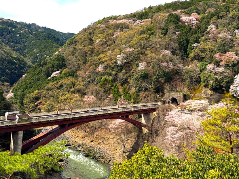
For cyclists in Kyoto, few routes offer the same blend of challenge and reward as this loop. Starting from Kameoka, this course takes you through Arashiyama, the Hozukyo Gorge, and Hiyoshi.
This guide covers a serious cycling route for intermediate to advanced riders, featuring everything from the historic Oinosaka Slope to the brutal gradients of Rokucho Pass and the scenic Hiyoshi Dam.
1. Route Overview: The “Full Course” of Kyoto’s Mountains and Rivers
This route spans Kameoka, Kyoto City, and Nantan, offering a dynamic mix of scenery and elevation changes.
[Route]
Kameoka → Oinosaka Slope → Arashiyama → Rokucho Pass → Hozukyo Gorge → Hiyoshi Dam (Springs Hiyoshi) → Izumo Daijingu Shrine → Kameoka
- Distance: Approx. 70–80 km
- Elevation Gain: Over 1,000 m (depending on specific paths)
- Estimated Time: 5–7 hours (including breaks and meals)
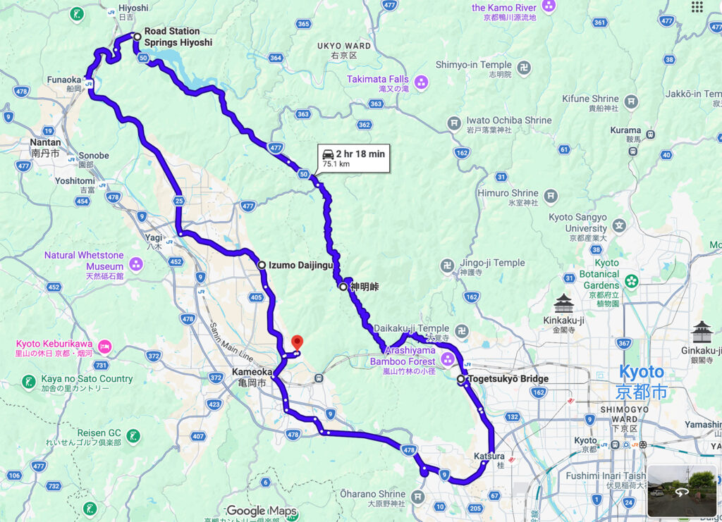
Here is the Google Maps route.
2. Course Guide: From Historic Slopes to Modern “Walls”
Warm-up: Oinosaka Slope to Arashiyama
Departing from Kameoka, your first challenge is the old Oinosaka Slope on Route 9. Once a formidable pass on the ancient San’in Road, it is now a relatively quiet stretch perfect for a brisk downhill sprint toward the Kyoto basin. Aim to reach the Sagano area before the Arashiyama tourist crowds arrive.
Kyoto Route 50: The Rokucho Pass Hill Climb
Past Saga Toriimoto lies the centerpiece of this route: Rokucho Pass.
- Average Gradient: Approx. 9.5%
- Maximum Gradient: 18%
This steep climb is essentially a “wall” condensed into a short distance. Your reward at the top is a breathtaking view overlooking the Hozukyo Gorge.
The Fast Lane to Hiyoshi Dam
After conquering Rokucho Pass, you enter a serene section along the gorge. Route 50 has almost no traffic lights, allowing you to find a perfect cadence. Breathing in the crisp mountain air as you head toward Hiyoshi Dam is the absolute highlight of the ride.
3. Pit Stop & Recovery | Michi-no-Eki Springs Hiyoshi
“Springs Hiyoshi” is the perfect place to refuel. You can recharge with their famous “Dam Curry” or local seasonal dishes. One of the best perks is the on-site hot spring (onsen), where you can refresh your legs before the return leg.
4. The Return Leg: Route 25 Back to Kameoka
The journey back from Hiyoshi takes you along Route 25 (Kameoka-Sonobe Line). With moderate undulations leading back into the Kameoka basin, this road offers peaceful pastoral views—especially beautiful at sunset—making for a calm conclusion to an intense ride.
5. Important Notes & Recommended Gear
- Gear: A wide gear ratio (32T or higher) is strongly recommended to tackle the 18% gradients.
- Supplies: There are no convenience stores between Arashiyama and Hiyoshi. Carry plenty of water and emergency snacks.
- Safety: The roads near Hozukyo are narrow with consecutive sharp curves. Exercise caution and control your speed on downhills.
6. Why Start and End in Kameoka?
To get the most out of this demanding loop, using “Kiri no Kōbō” as your base camp offers distinct advantages:
- Optimal Warm-up: The roads leading to Route 50 are low-intensity, providing the perfect warm-up for your muscles.
- Beat the Crowds: An early start from Kameoka allows you to clear the Oinosaka and Arashiyama areas before the midday congestion.
Additional Info: Kyoto Tamba Cycling Routes
We’d also like to introduce the “Kyoto Tamba Cycling Routes” developed by Kyoto Prefecture. There are five different courses ranging from beginner to advanced levels, all starting from Sanga Stadium by KYOCERA—just a 5-minute bike ride from Kiri-no-Kobo.
The Kyoto Tamba area, spanning Kameoka, Nantan, and Kyotamba, is home to Japan’s quintessential landscapes, including traditional thatched-roof villages and scenic rice fields. These routes are perfect for photography. A major highlight is that they follow backroads with minimal traffic, allowing you to enjoy a peaceful ride away from the main highways.
Click here for Kyoto Tamba Cycling Routes (Japanese)
PDF Map (English): Guide / Map